NT Fishing Grid Maps
Official NT Fisheries reference maps. Tap any sheet to view and select a grid.
Source: NT Fisheries — Official Fishing Tour Operator Grid Reference Maps
Official NT Fisheries reference maps. Tap any sheet to view and select a grid.
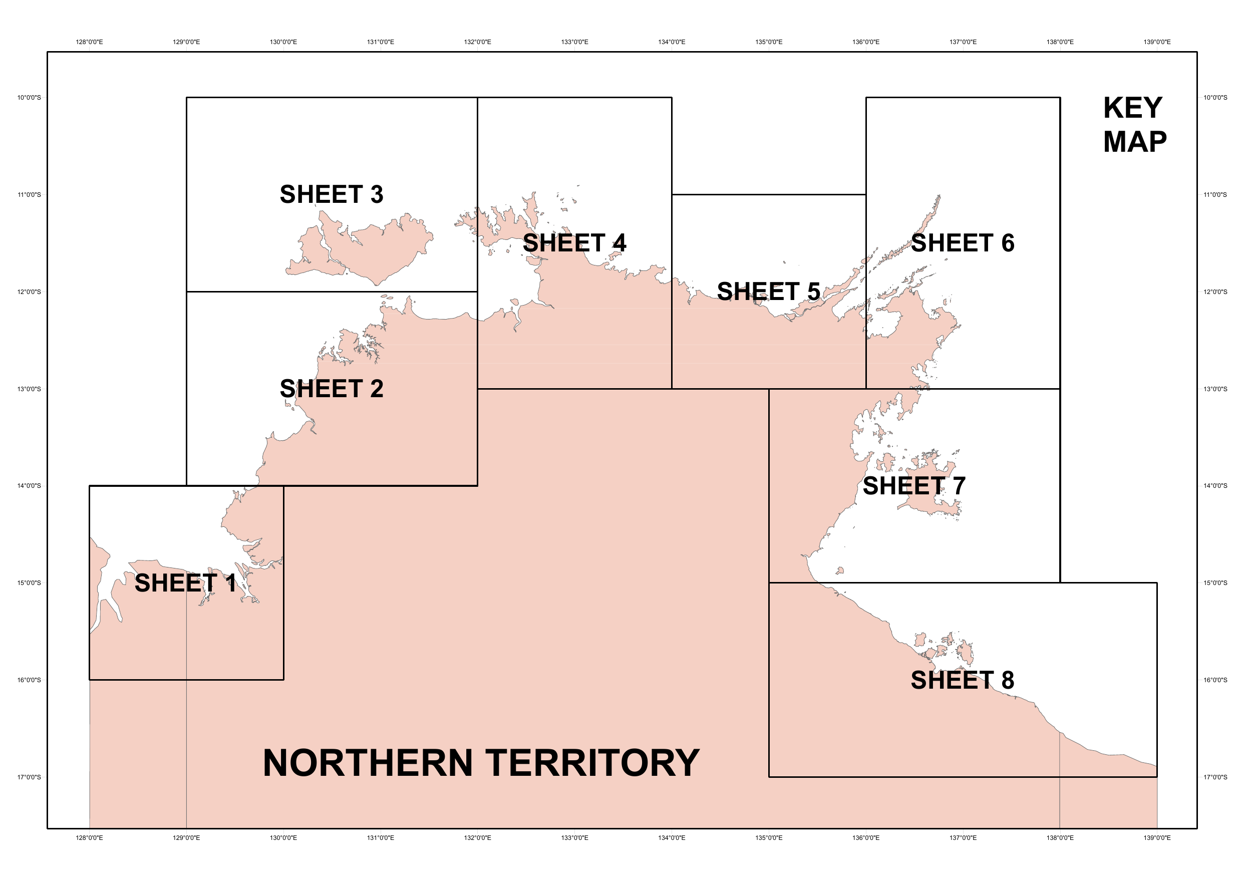
Key Map — All Sheets Overview
Shows the geographic position of all 8 detailed sheets
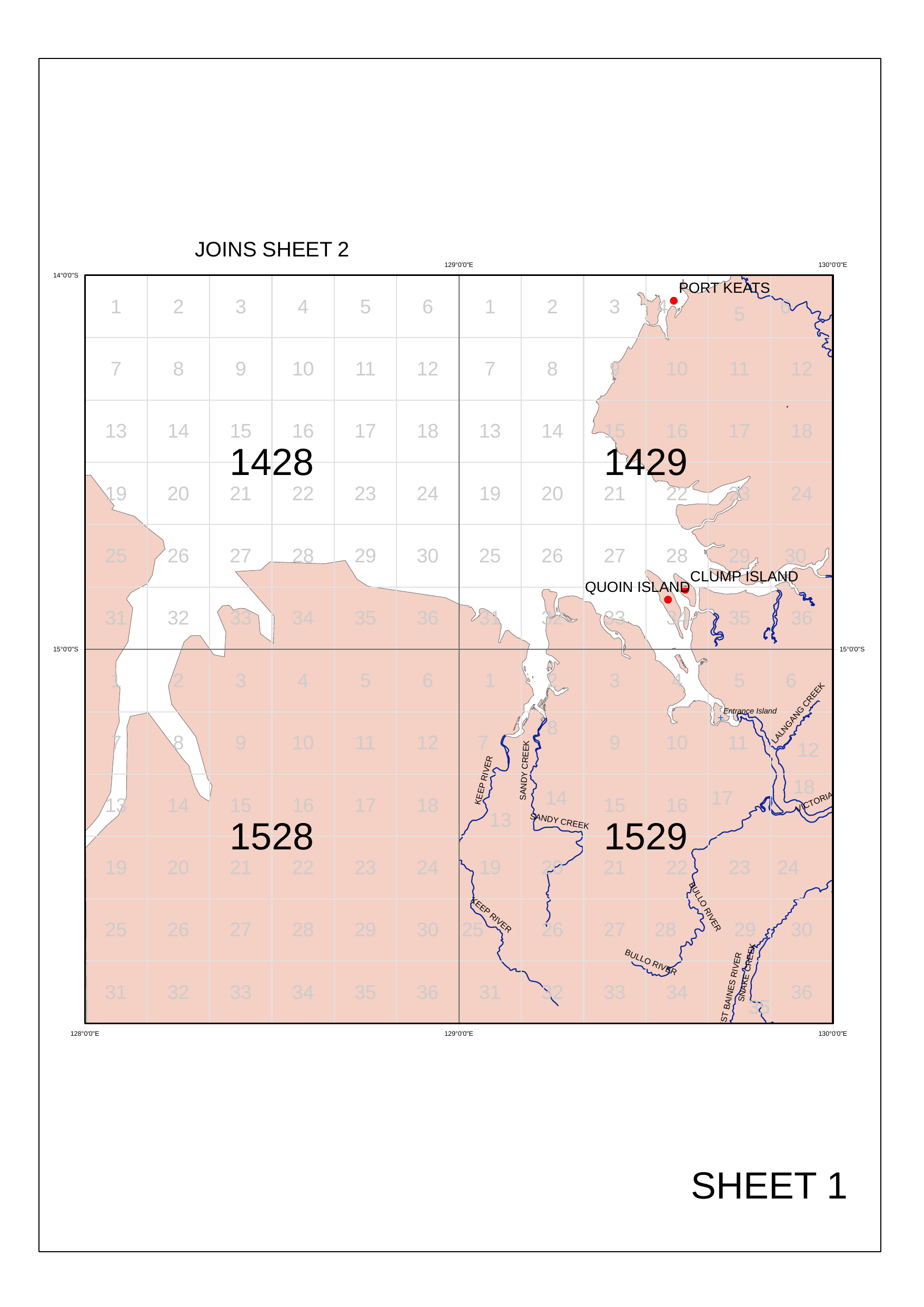
SW NT Coast
Port Keats · Quoin Island · Bullo River
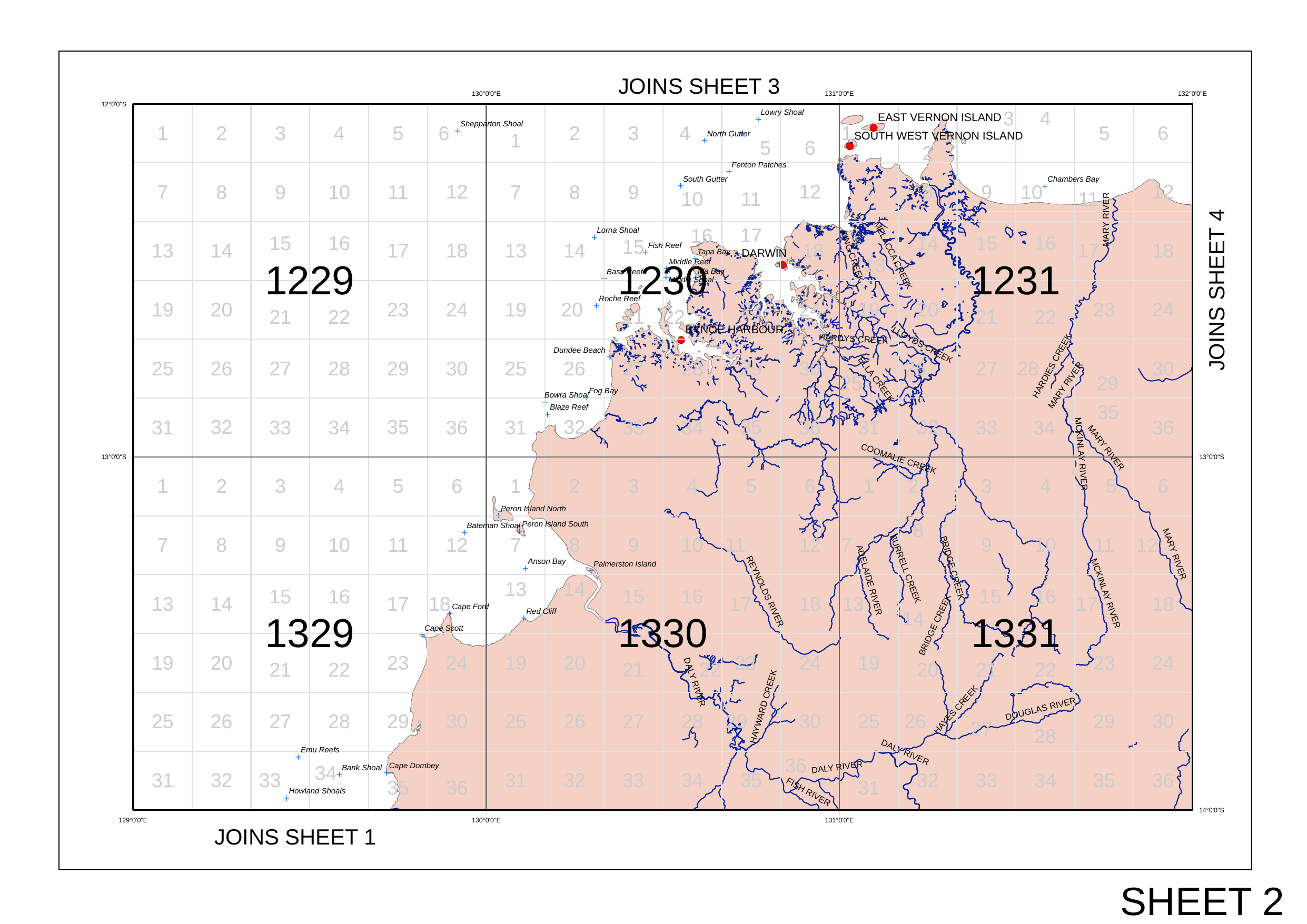
Darwin Region
Darwin Harbour · Beagle Gulf · Daly River · Mary River
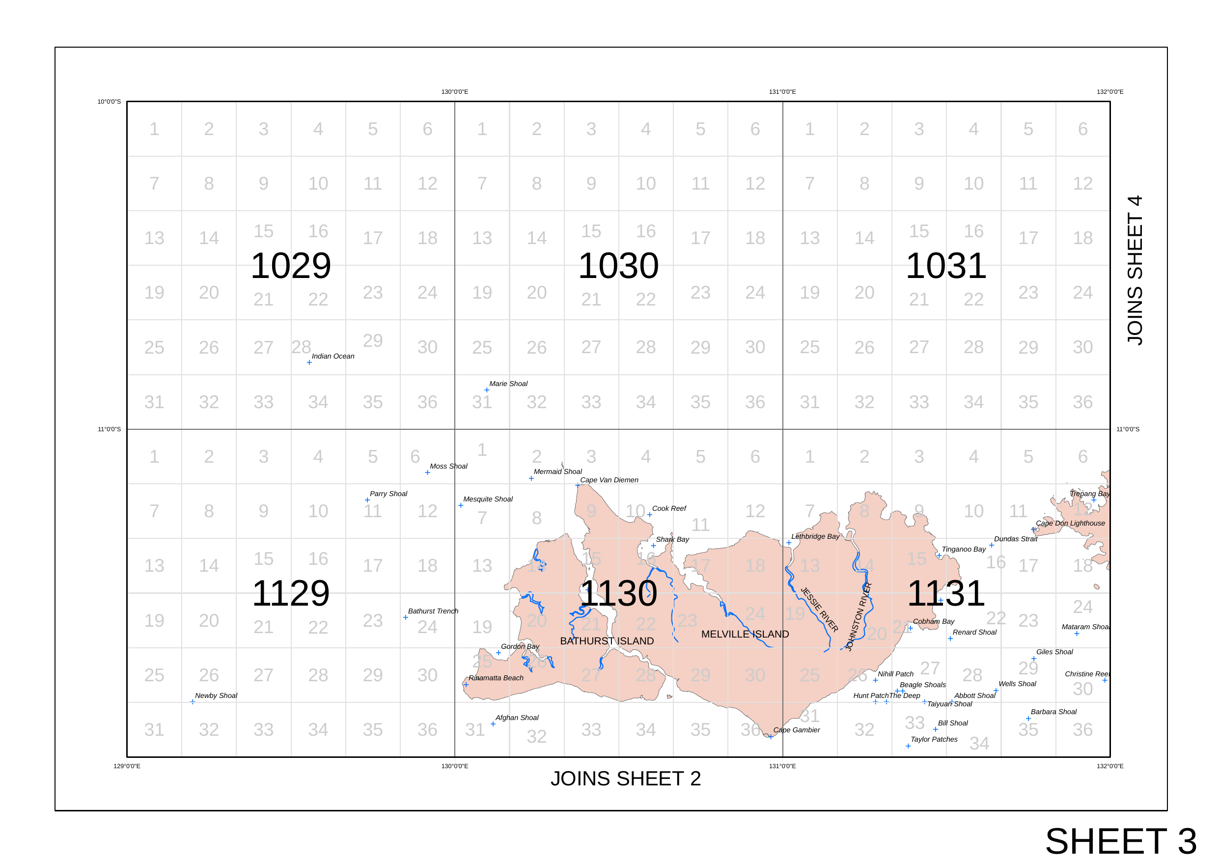
Bathurst / Melville Islands
Bathurst Island · Melville Island · Jessie River
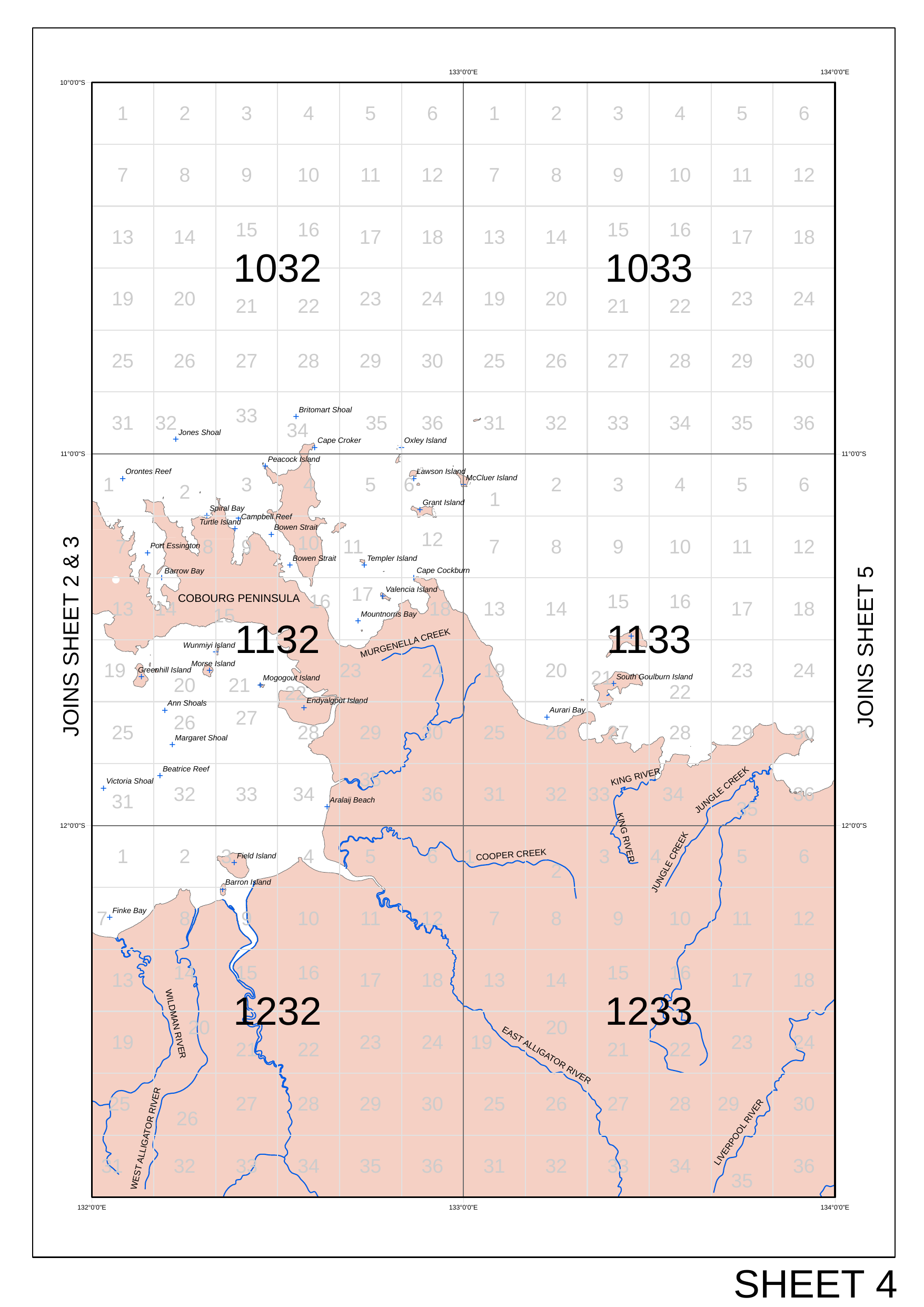
Cobourg / Arnhem Land West
Cobourg Peninsula · Timor Sea · Alligator Rivers
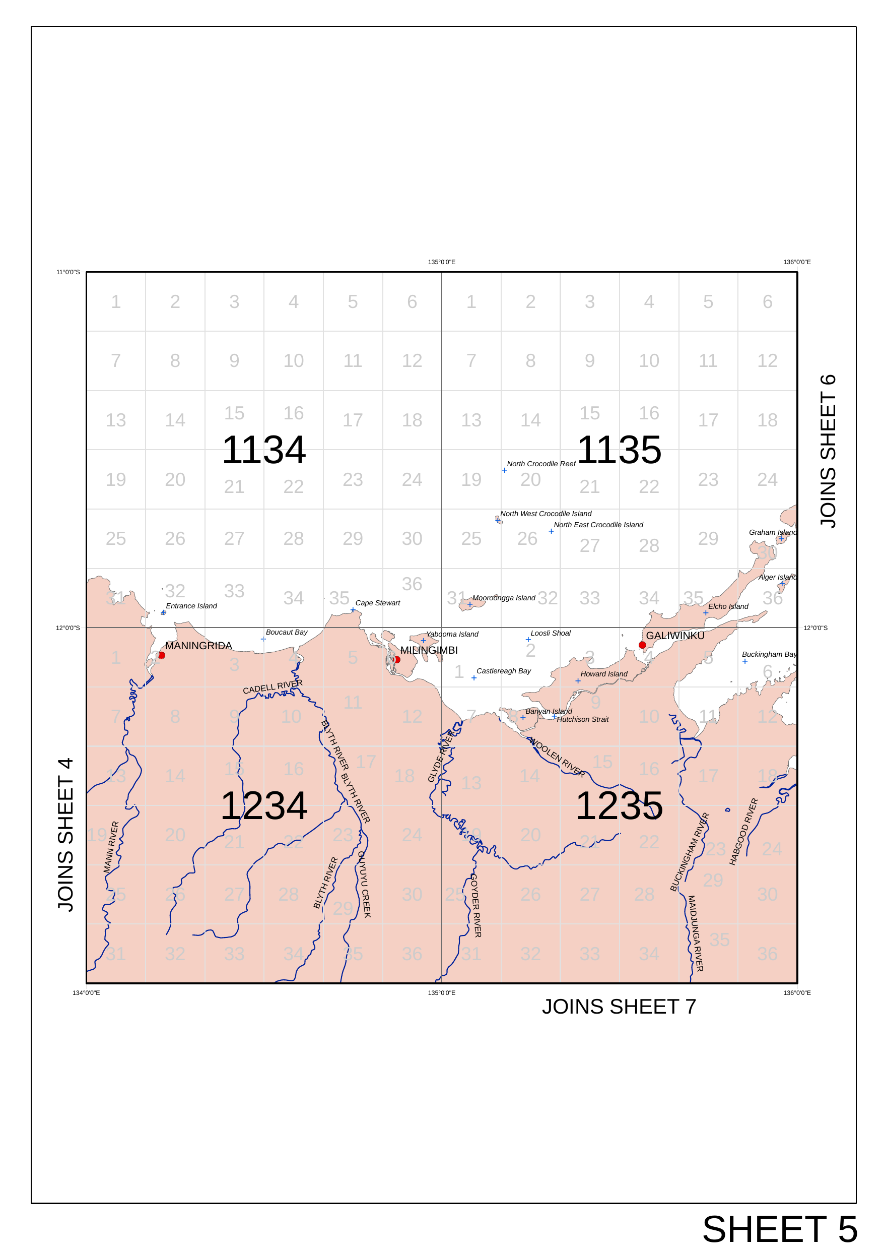
Maningrida / Milingimbi / Galiwinku
Maningrida · Cadell River · Crocodile Islands · Buckingham Bay
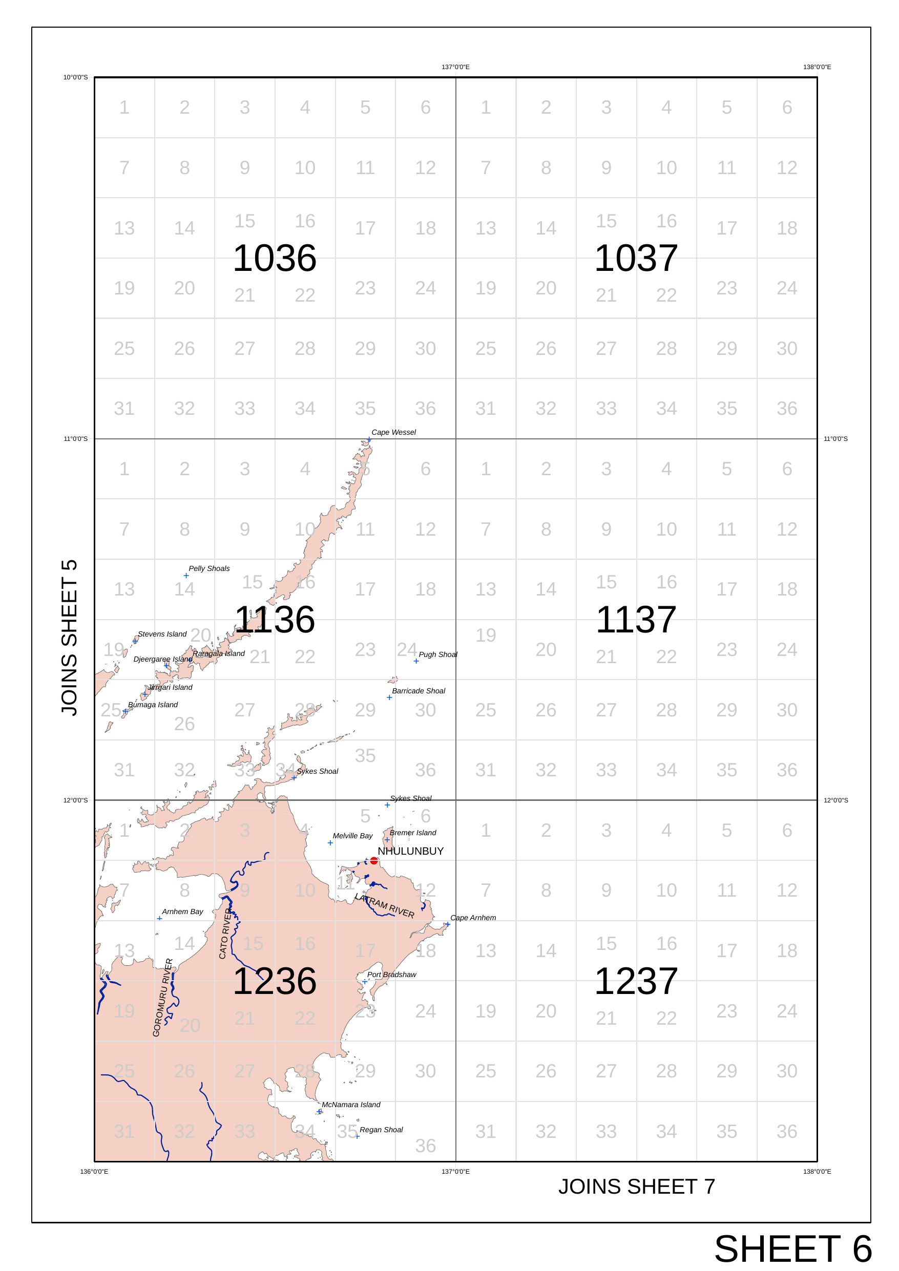
Nhulunbuy / Arnhem Land East
Nhulunbuy · Cape Wessel · Arnhem Bay · Arafura Sea

Gulf of Carpentaria West
Groote Eylandt · Numbulwar · Blue Mud Bay · Gulf Central
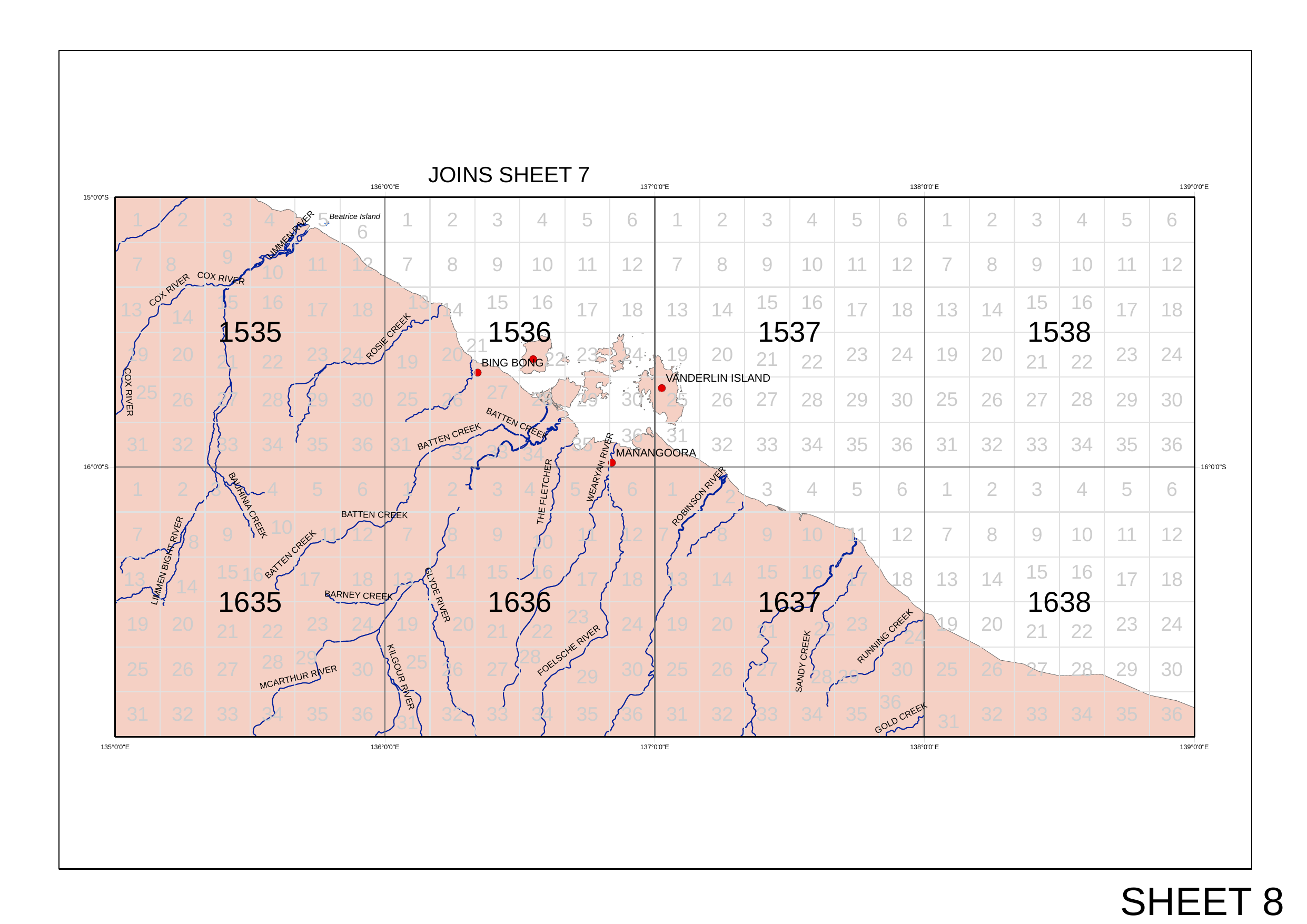
Gulf of Carpentaria South
Bing Bong · Vanderlin Island · McArthur River · Gulf Far SE
Source: NT Fisheries — Official Fishing Tour Operator Grid Reference Maps